The DMZ has turned into a repository of biodiversity from the ashes of the war
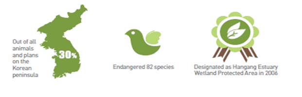
In the vicinity of the DMZ, various, important natural ecological areas exist including excellent vegetation regions, wetlands, habitats for fare flora, and natural scenic sites as well as 2,930 species of higher plants and vertebrates. This accounts for 30% of all animals and plants that are inhabiting and dispersed on the Korean peninsula, including endangered 82 species, for example, cranes, spoonbills, otters, and goats. In particular, the international community is paying attention to Hangang River Estuary Neutral Zone to protect migratory birds. It was designated as Hangang Estuary Wetland Protected Area in 2006.
The DMZ has turned into the ecological axis from east to west on the Korean peninsula
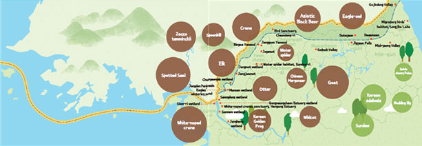
The DMZ is a 248km-long ecological axis that links east and west of the Korean peninsula. It is a core ecological axis along with Baekdudaegan, which connects north and south. The east-west ecological axis consists of the following three regions:
First, the central east mountainous area. Located at the basin of Bukhangang River from Baekdudaegan to Hanbukjjeongmaek, it includes high mountains and dense forests. The whole area of Hyangnobong Peak maintains ecosystem close to virgin forest. At the top of Daeamsan Mountain is Yongneup Swamp, the only high moor in Korea.
Second, the central western inland. It includes Cheorwon Plain, a volcanic region in the basin of Hantangang River. Imjingang River is flowing. Cranes and white-naped cranes stay during the winter.
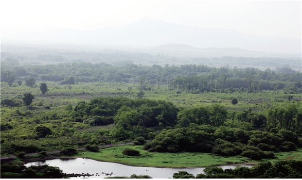
Third, western area. Extensive wetlands and mud flats are developed including Hangang River and Imjingang River estuary. Hangang River estuary is the only natural estuary left in South Korea.
In sum, habitats and land cover of the DMZ district are formed in an east-highwest-low type: from mountainous areas in the east to flat areas in the west, including estuaries and mud flats.
The DMZ is preserving the geological history of the Korean peninsula
Chugaryeong structural valley, which is flowing through the Korean peninsula, Jusangjeolli and red cliff, which are formed along Hantangang and Imjingang River, show the geological history of the Korean peninsula and boast beautiful scenery, enormous value as tourist attractions.